
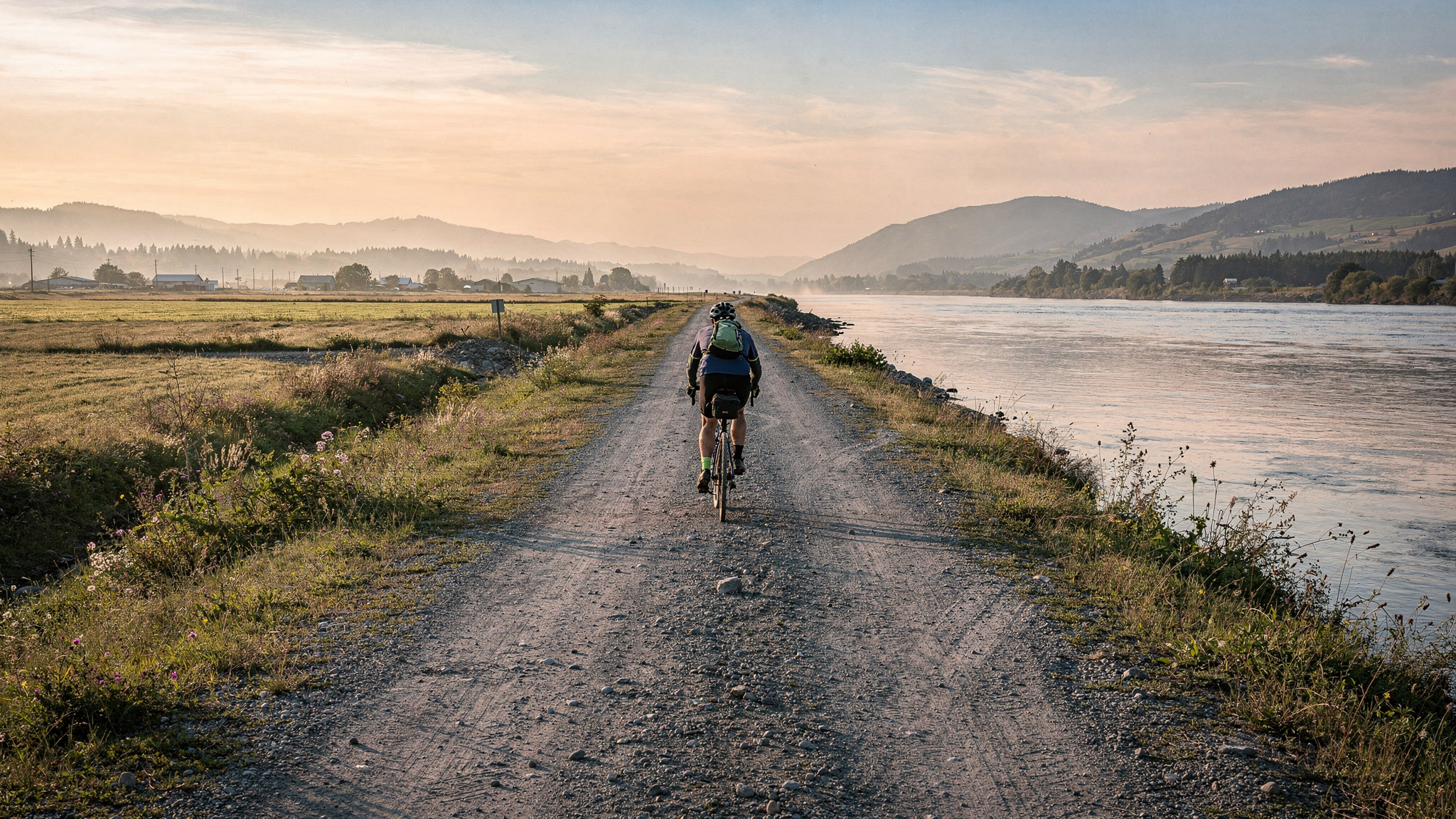
The Matsqui Trail runs along the top of the Fraser River dyke for 28 kilometres between the Mission Bridge at the western end and Page Road in Abbotsford to the east. It is one of the few long-distance trail experiences in the Lower Mainland that is genuinely flat, making it accessible to cyclists, families with young children, people pushing strollers, and anyone who wants the reward of a long river walk without the demands of elevation gain. The trail sits on the south bank of the Fraser, which places it on the Abbotsford and Matsqui Prairie side of the river, and the views north across the water take in Mission, the forested slopes above the river, and on clear days the entire run of the Coast Mountains.
Metro Vancouver Regional District manages the trail as part of its regional park system, and the dyke infrastructure has been maintained by the Fraser Valley Regional District and its predecessor bodies for over a century. The dyke itself was constructed to protect the Matsqui Prairie from the seasonal flooding that historically covered much of this low-lying land. Walking or cycling on top of it gives a vantage point that is slightly elevated above the surrounding fields and provides unobstructed sightlines across the river and back toward Sumas Mountain to the south.
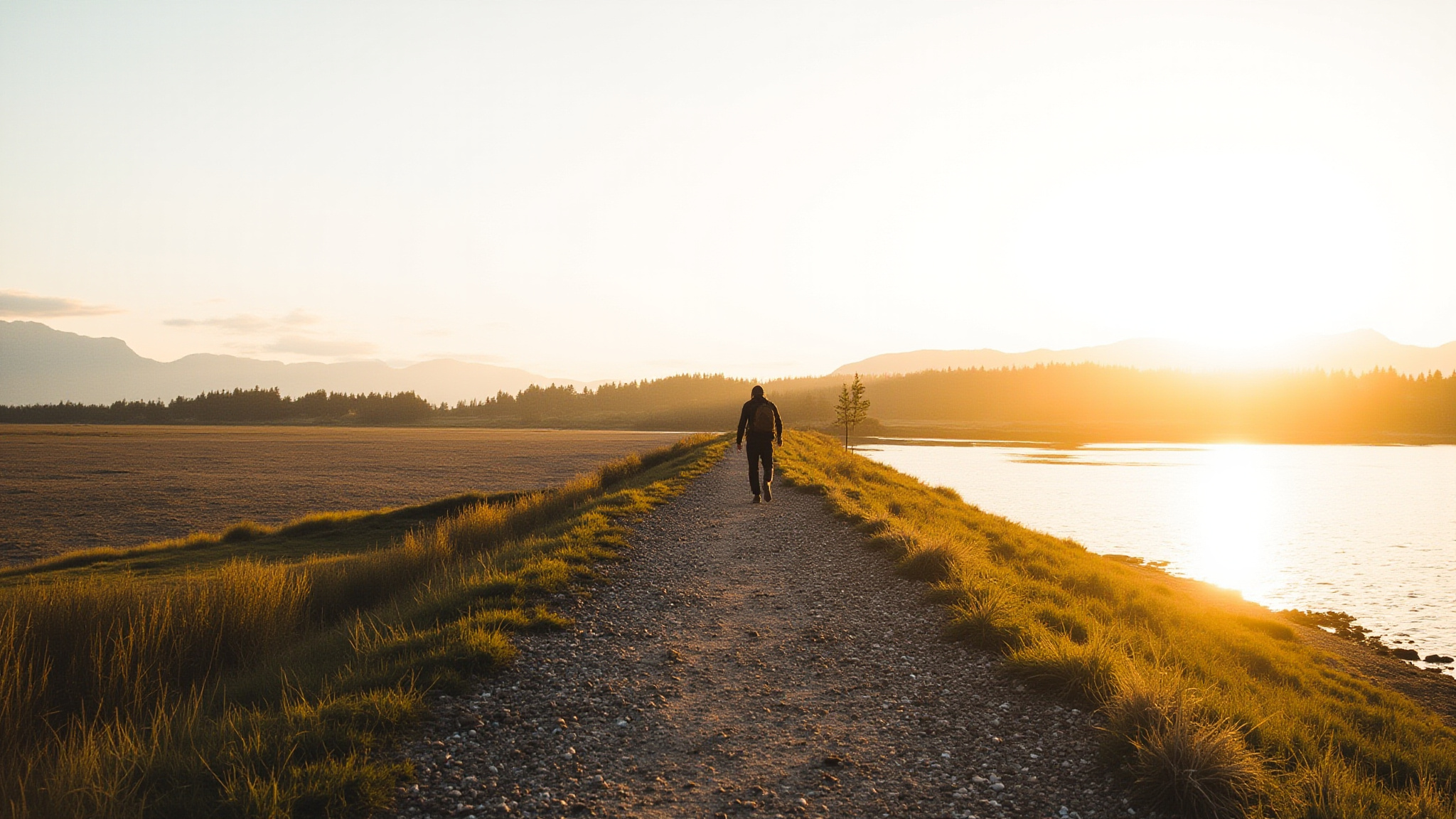
The Trail: 28 Kilometres of Flat River Dyke
The Matsqui Trail runs on a gravel and packed-earth surface along the crest of the Fraser River dyke. The surface is wide enough for cyclists and walkers to share comfortably, though the trail is not paved and can become muddy in wet weather near the access points. Mountain bikes handle the surface easily and road bikes with wider tires are manageable, but narrow-tired road bikes may find it slow going in softer sections. The trail is open year-round and sees use in every season, though winter and spring bring the most dramatic landscape changes.
The western trailhead connects near the Mission Road Bridge, where the trail meets the Mission side of the river crossing. The most commonly used access point on the Abbotsford side is the Page Road trailhead, which has parking and is well-signed from Clearbrook Road. Several informal access points exist along the dyke at road crossings, allowing users to create shorter loops or point-to-point routes with a vehicle shuttle. The full 28-kilometre length, walked end to end, takes roughly six to eight hours at a comfortable pace.
Cycling the full trail and back is a popular half-day trip for local cyclists. The flat grade means that wind is the main variable: a westerly wind at your back on the way out becomes a headwind on the return. Many cyclists time their rides to go east in the morning before the prevailing westerly builds and return with the wind in the afternoon. The trail is popular with families and the pace is generally unhurried, making it a good choice for introducing younger riders to longer distances.
Fraser River Views and Landscape
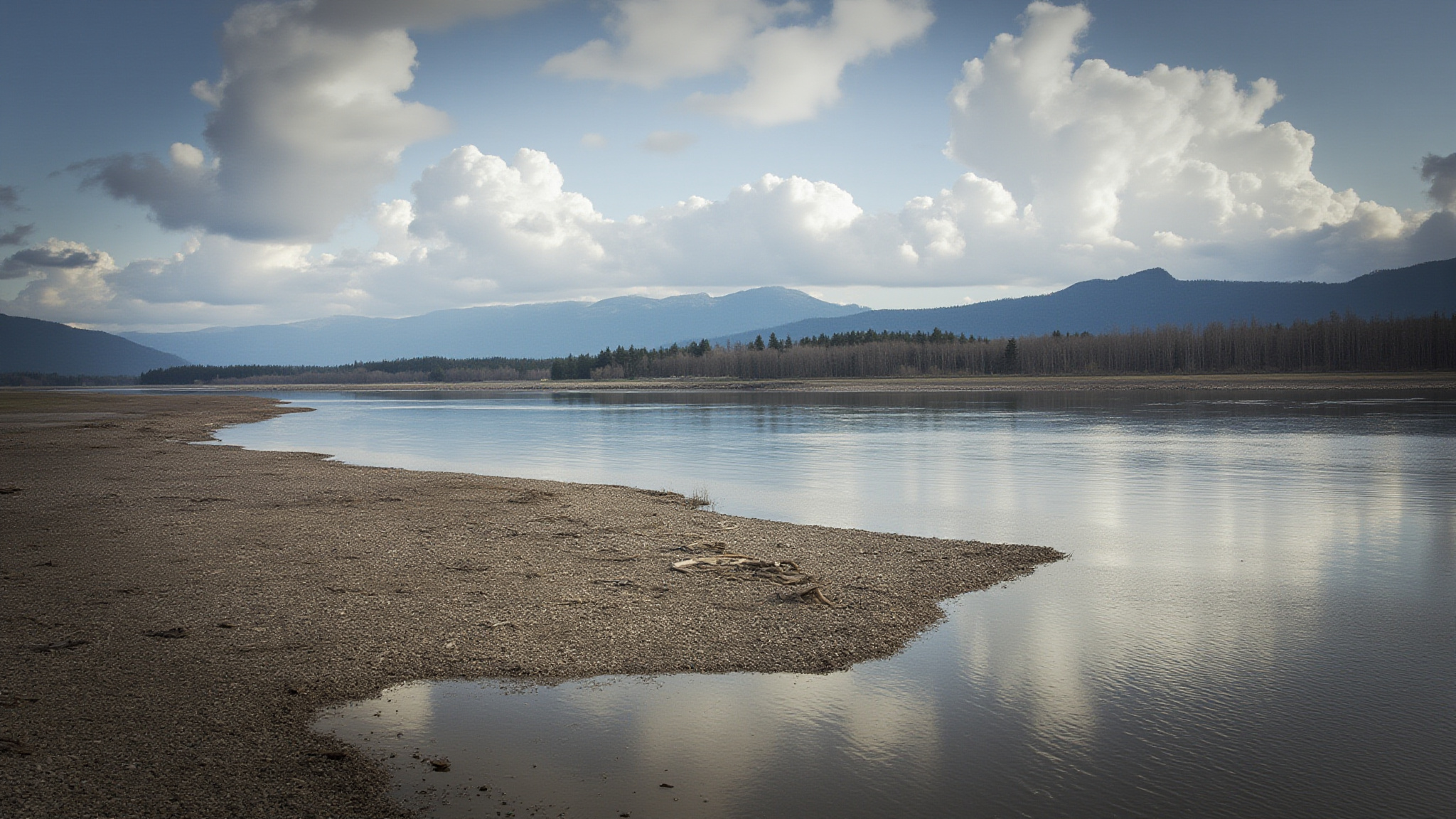
The Fraser River at this point is a wide, powerful, silty river moving through a broad floodplain. The colour ranges from a grey-green in summer when glacial melt dominates to a darker brown during high-water events when the river carries heavy sediment loads. The river is not calm or glassy here but has a visible current and mid-channel ripples even in dry periods. Sandbars and gravel bars appear and shift through the summer as water levels drop from the spring peak, and these become resting spots for shorebirds and eagles.
Looking north from the dyke, the river occupies the foreground and the town of Mission sits on the opposite bank, its streets visible rising up the hillside. Beyond Mission the terrain becomes forested and steep, part of the Coast Mountains foothills that rise sharply from the river valley. On clear days the view west extends toward the Pitt Meadows lowlands and the silhouette of Golden Ears and other summits above Maple Ridge. The view is open and genuinely expansive in a way that is unusual this close to Metro Vancouver.
Sumas Mountain, at 891 metres, is the dominant landmark to the south of the trail. Its forested slopes rise abruptly from the flat Matsqui Prairie and are visible for most of the trail’s length. The mountain is part of Sumas Mountain Regional Park and its summit trails are accessible from Abbotsford. In winter and spring, snowfall on the upper slopes is visible from the dyke, and the contrast between the snow-capped summit and the flooded fields of the floodplain below is one of the more striking views in the region.
Wildlife Along the Trail
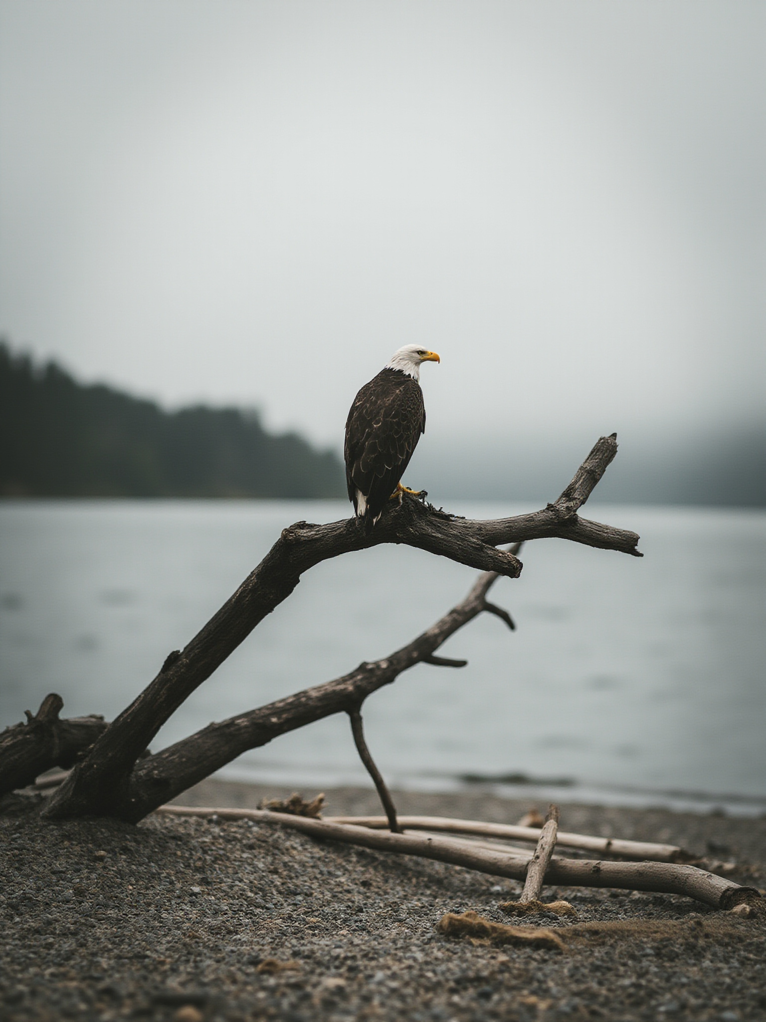
The Matsqui Trail is one of the better accessible birdwatching locations in the eastern Fraser Valley. Bald eagles are present year-round but concentrations are highest from November through February, when spawning salmon in the river and cold-weather refuging behaviour bring large numbers to the cottonwood trees along the bank. Counts of twenty to forty eagles in a short stretch of trail are not unusual in winter, and the birds are often perched low enough for clear viewing without binoculars.
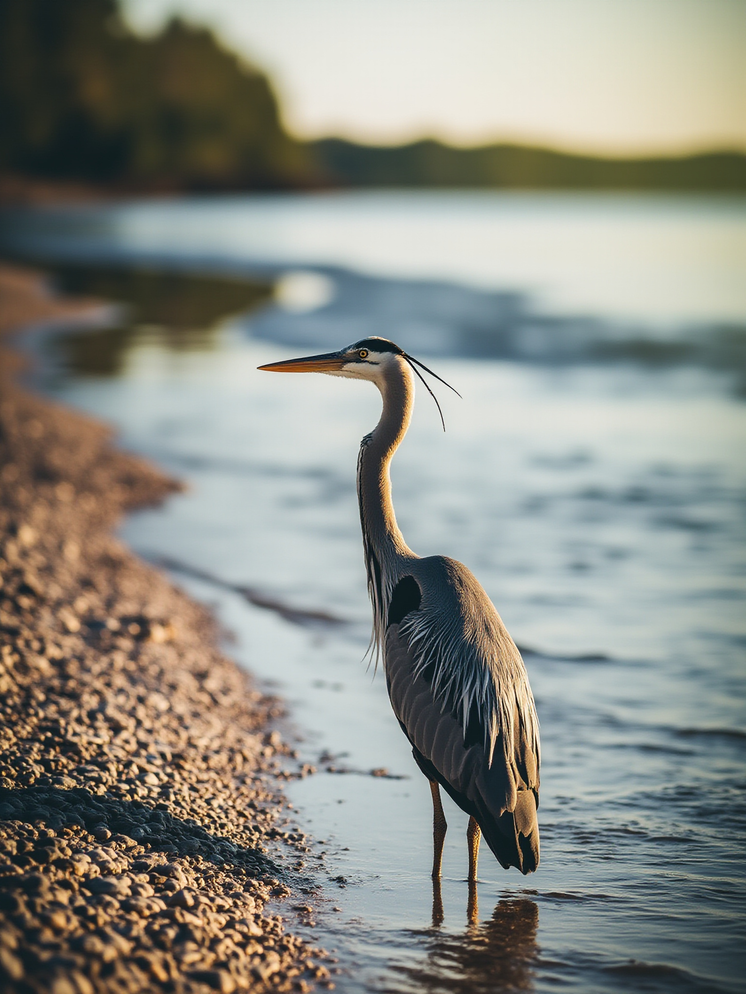
Sandhill cranes pass through the Matsqui Prairie during fall migration, typically in September and October. Flocks of several hundred birds are regular, and the larger flights can number in the thousands. The cranes feed in the agricultural fields adjacent to the dyke before continuing south, and their distinctive bugling calls carry a long distance. Great blue herons are present year-round, hunting the shallows along the river edge and standing motionless in the flooded fields during high-water periods.
The river itself supports a range of waterfowl depending on season. Common mergansers, buffleheads, and hooded mergansers use the river in winter. In summer, osprey hunt the shallower sections and can be watched diving from considerable height. Swallows, including tree swallows and violet-green swallows, hunt insects over the water throughout the warm months. The combination of river, agricultural land, and remnant cottonwood riparian forest makes the Matsqui corridor genuinely diverse for birds.
Seasonal Changes and Flooding
The Fraser River dyke the trail follows was built specifically to contain the seasonal flooding that once covered the Matsqui Prairie each spring. Before the dyke was constructed in the early twentieth century, most of this flat land was inundated each year by snowmelt from the Interior and Coast Mountains. The dyke keeps the floodplain dry and farmable, but the landscape on both sides of it changes dramatically with the river’s level through the year.
Spring brings the highest drama to the trail. As snowmelt in the Interior moves downstream through May and June, the Fraser rises dramatically and the floodplain outside the dyke can flood in high-water years. The river takes on a deeper, more powerful character and the current is visibly stronger. Some sections of the trail approach the waterline more closely than at other times of year. The contrast between the churning brown river and the green fields behind the dyke is striking and completely different from the drier summer landscape.
Winter visits have their own appeal. The bare cottonwood trees along the bank are occupied by eagles in the way that dense foliage would make impossible in summer. The low angle of winter light makes the river surface almost metallic in the late afternoon. Frost on the dyke gravel and ice at the edges of drainage channels beside the trail add texture to what can otherwise be a monotonous surface. The trail sees fewer users in winter, which means more solitude and more wildlife activity undisturbed by trail traffic.
Getting to the Matsqui Trail
The Page Road trailhead is the primary Abbotsford access point and is located off Clearbrook Road near the western edge of the city. There is a gravel parking lot at the trailhead with space for roughly thirty vehicles. The lot fills on summer weekends by mid-morning, so arriving before 9:00 on busy days is advisable. The trailhead has basic signage and a portable toilet but no other facilities, so carrying water and snacks is recommended for longer outings.
The Mission end of the trail is accessible from the south side of the Mission Road Bridge. This is a less-used access point with more limited parking but works well for a one-way trip with a vehicle shuttle. Some users park at one end and cycle or walk to the other, arranging transport back. The distance between the two main trailheads is the full 28 kilometres, which is a committed commitment without a shuttle.
Abbotsford is accessible from Metro Vancouver via Highway 1, with the Clearbrook Road exit providing direct access to the Page Road trailhead area. The drive from Burnaby is approximately 50 kilometres and takes 45 to 60 minutes depending on traffic. The trail is within the Metro Vancouver Regional Parks system, so there is no entry fee and it is open to the public year-round.
Tips for the Matsqui Trail
Bring water and sun protection for summer visits. The dyke top is completely exposed with no shade for most of the trail’s length. Wind from the west is common and can be strong enough to be a significant factor for cyclists. Layers are useful in spring and fall when the river valley can hold cold air even on sunny days.
Birdwatching is best in the early morning before trail traffic builds. Bringing binoculars is worthwhile, particularly from October through February when eagle concentrations are at their peak. The river edge is most productive for shorebirds and waterfowl; the agricultural fields to the south of the dyke are better for cranes and raptors during migration periods.
The trail surface becomes soft in some sections after heavy rain. Mountain bikes or hybrid bikes handle this best. Road bikes with tires narrower than 28mm will find some sections slow going after wet weather. The most heavily used sections near the trailheads tend to have the firmest surface because the traffic compacts the gravel.
Dogs are welcome on the trail and the flat open terrain is excellent for off-leash exercise in the designated areas. Check current Metro Vancouver Regional Parks regulations for leash requirements, as these vary by season in some parks to protect ground-nesting birds in the adjacent fields during spring.
Questions Often Asked
How long is the Matsqui Trail and how difficult is it?
The Matsqui Trail is 28 kilometres long running along the top of the Fraser River dyke between Abbotsford and the Mission Bridge. The trail is entirely flat with no significant elevation gain, making it one of the most accessible long-distance trails in the Fraser Valley. It is suitable for cyclists, walkers, families with strollers, and most fitness levels.
Where do you park for the Matsqui Trail in Abbotsford?
The main Abbotsford access is the Page Road trailhead, located off Clearbrook Road in the western part of the city. There is a gravel parking lot at the trailhead. The lot can fill on summer weekends, so arriving before 9:00 AM is advisable. The Mission end of the trail has additional parking near the south side of the Mission Road Bridge.
What wildlife can you see on the Matsqui Trail?
Bald eagles are the most notable wildlife and are present year-round, with highest concentrations from November through February. Sandhill cranes pass through in September and October during fall migration. Great blue herons, osprey, and a variety of waterfowl are common depending on the season. The trail is one of the better birdwatching locations in the eastern Fraser Valley.
Is the Matsqui Trail open in winter?
Yes, the trail is open year-round. Winter visits offer the chance to see large concentrations of bald eagles in the bare cottonwood trees along the river. The trail surface can be softer after heavy rain but is generally passable. Spring brings high river levels and dramatic landscape changes as snowmelt moves downstream.